COLLECTION NAME:
David Rumsey Historical Map Collection
Record
Author:
Everts & Kirk
Author:
Mann, Adin, 1816-1903
Date:
1885
Short Title:
York Co.
Publisher:
Everts & Kirk
Publisher Location:
Philadelphia
Type:
Atlas Map
Obj Height cm:
37
Obj Width cm:
32
Scale 1:
126,720
Note:
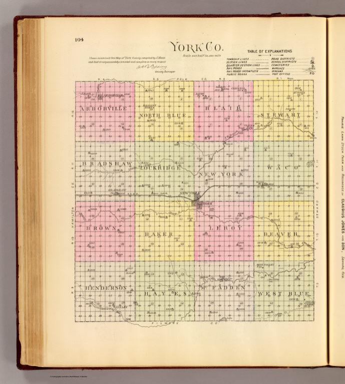
Lithographed map. Hand colored. Shows townships, sections, quarter sections, railroads, roads, rural buildings, post offices, etc. "I have examined this map of York County compiled by A. Mann ... A.B. Codding, County Surveyor."
State/Province:
Nebraska
County:
York County (Neb.)
Full Title:
York Co. (Philadelphia, Everts & Kirk, 1885)
List No:
2719.093
Page No:
104
Series No:
97
Publication Author:
Everts & Kirk
Pub Date:
1885
Pub Title:
The official state atlas of Nebraska. Compiled from government surveys, county records and personal investigations. Philadelphia, Everts & Kirk, 1885. (on verso) Copyright, 1885, Everts & Kirk.
Pub Reference:
Checklist of printed maps of the Middle West to 1900, 12-0566; Phillips, 2107; LeGear. Atlases of the United States, 2184; Phillips. Maps of America, p. 461.
Pub Note:
See note field above.
Pub List No:
2719.000
Pub Type:
State Atlas
Pub Maps:
163
Pub Height cm:
45
Pub Width cm:
38
Image No:
2719093
Authors:
Everts & Kirk; Mann, Adin, 1816-1903
Collection:
Rumsey Collection
Link To Source

York Co.