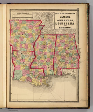
Detail View: David Rumsey Historical Map Collection: Alabama, Arkansas, Louisiana, and Mississippi.
|
Author:
|
Lloyd, H.H.
|
|
Date:
|
1873
|
|
Short Title:
|
Alabama, Arkansas, Louisiana, and Mississippi.
|
|
Publisher:
|
Stedman, Brown & Lyon
|
|
Publisher Location:
|
Baltimore
|
|
Type:
|
Atlas Map
|
|
Obj Height cm:
|
41
|
|
Obj Width cm:
|
31
|
|
Scale 1:
|
3,000,000
|
|
Note:
|
Hand col. lithographed map. Counties in full color.
|
|
State/Province:
|
Alabama
|
|
State/Province:
|
Arkansas
|
|
State/Province:
|
Louisiana
|
|
State/Province:
|
Mississippi
|
|
Full Title:
|
Atlas of the United States. Alabama, Arkansas, Louisiana, and Mississippi. (by H.H. Lloyd. Published by Stedman, Brown & Lyon, Baltimore. 1873)
|
|
List No:
|
2239.029
|
|
Page No:
|
106
|
|
Series No:
|
32
|
|
Publication Author:
|
Gray, Ormando Willis
|
|
Publication Author:
|
Lloyd, H.H.
|
|
Publication Author:
|
Martenet, Simon J.
|
|
Publication Author:
|
Walling, H. F.
|
|
Pub Date:
|
1873
|
|
Pub Title:
|
New topographical atlas of the State of Maryland and the District of Columbia. With descriptions historical, scientific, and statistical, together with maps of the United States and Territories. By S.J. Martenet, H.F. Walling, and O.W. Gray, civil and topographical engineers. Published by Stedman, Brown & Lyon, Baltimore. 1873. (on verso) Entered ... 1872, by H.F. Walling, and O.W. Gray, and Simon J. Martenet ... Washington.
|
|
Pub Reference:
|
Phillips 1497,1780; LeGear Atlases of the United States, L1524; Phillips Maps of America, p. 266, 398.
|
|
Pub Note:
|
With maps of U.S. by H.H. Lloyd (no imprint). These Lloyd maps are in a different configuration than the Lloyd maps(from the same base) used in Warner, Higgins & Beers "Atlas of Illinois," 1871. Full color maps. Covers are half leather brown cloth covered boards with "Atlas of Maryland, District of Columbia and the United States" stamped in gilt.
|
|
Pub List No:
|
2239.000
|
|
Pub Type:
|
State Atlas
|
|
Pub Maps:
|
30
|
|
Pub Height cm:
|
45
|
|
Pub Width cm:
|
36
|
|
Image No:
|
2239029
|
|
Download 1:
|
|
|
Download 2:
|
|
|
Authors:
|
Lloyd, H.H.
|
|
Collection:
|
Rumsey Collection
|