COLLECTION NAME:
David Rumsey Historical Map Collection
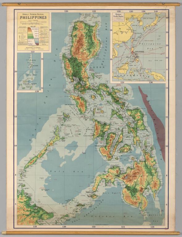
Record
Author:
Rand McNally
Date:
1952
Short Title:
Philippines -- Physical-Political.
Publisher:
Rand McNally
Publisher Location:
Chicago
Type:
Wall Map
Obj Height cm:
138
Obj Width cm:
98
Scale 1:
1,200,000
Note:
Suitable for use in a standard classroom; viewable up to 40 feet. Language(s): English. Map is paper. Mounted on wood rods. Prime Meridian is Greenwich. Projection is Lambert's conformal conic. Topics include: topography, hydrography, cities and towns, transportation routes, internal political boundaries. Department of Geography, University of California at Berkeley, Call Number 255-A-3.
Reference:
Current editions available from http://store.randmc… UC Berkeley, Geography Department Call Number 255-A-3.
Country:
Philippines
Subject:
Physical
Full Title:
Phillipines, Western Pacific Region.
List No:
7001.000
Series No:
1
Publication Author:
Rand McNally
Pub Date:
1952
Pub Title:
Phillipines, Western Pacific Region.
Pub Reference:
UCBGEOG1
Pub List No:
7001.000
Pub Type:
Wall Map
Pub Maps:
1
Pub Height cm:
138
Pub Width cm:
98
Image No:
7001000
Download 1:
Map may not be downloaded, for viewing only.
Authors:
Rand McNally
Link To Source