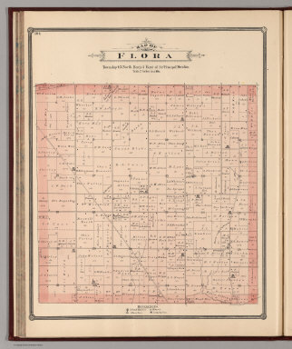
Detail View: David Rumsey Historical Map Collection: Flora Township, Boone County, Illinois.
|
Author:
|
Page, H.R. & Co.
|
|
Date:
|
1886
|
|
Short Title:
|
Flora Township, Boone County, Illinois.
|
|
Publisher:
|
H.R. Page & Co.
|
|
Publisher Location:
|
Chicago
|
|
Type:
|
Atlas Map
|
|
Obj Height cm:
|
42
|
|
Obj Width cm:
|
34
|
|
Scale 1:
|
31,680
|
|
Reference:
|
P1517,1579.
|
|
County:
|
Boone County (Ill.)
|
|
Full Title:
|
Map of Flora, Township 43 North, Range 3 East of 3rd Principal Meridian.
|
|
List No:
|
2861.074
|
|
Page No:
|
104
|
|
Series No:
|
74
|
|
Engraver or Printer:
|
Rand McNally and Company
|
|
Publication Author:
|
Page, H.R. & Co.
|
|
Pub Date:
|
1886
|
|
Pub Title:
|
Illustrated Atlas Of Winnebago And Boone Counties, Illinois ... Also Maps of Michigan, Indiana, Ohio, Illinois, Wisconsin, Minnesota, Iowa, Missouri, Dakota, Nebraska, Kansas, Montana, Colorado, New Mexico, Arizona, Texas, and Washington Territory. Compiled from Late and Authentic Sources, Together with Other Valuable Information. Published By H.R. Page & Co. Chicago. Copyrighted 1886.
|
|
Pub Reference:
|
P1517,1579.
|
|
Pub Note:
|
Includes 17 state maps. A two county atlas, plus good maps of several western states, plus many views, and a large folding map of Rockford, Illinois, in a back pocket. Page made only five atlases according to Phillips. They also made pocket maps of the state maps in this atlas (see our Dakota). With hand painted and printed full color.
|
|
Pub List No:
|
2861.000
|
|
Pub Type:
|
County Atlas
|
|
Pub Maps:
|
54
|
|
Pub Height cm:
|
47
|
|
Pub Width cm:
|
38
|
|
Image No:
|
2861074
|
|
Download 1:
|
|
|
Download 2:
|
|
|
Authors:
|
Page, H.R. & Co.
|